


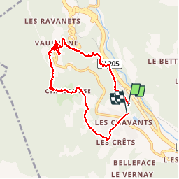

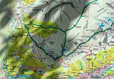
13.1 km | 28 km-effort


User


FREE GPS app for hiking
 SityTrail
IGN / Geographical institutes
SityTrail World
The world is yours!
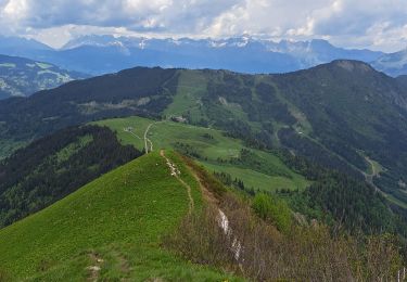
Trail Walking of 9.2 km to be discovered at Auvergne-Rhône-Alpes, Upper Savoy, Les Houches. This trail is proposed by YannPro81.
Les Houches

Walking

Running
Walking
Walking
Walking
Walking

Walking
Walking

Walking
belle ballade digestive endroit magnifique
Balade très agréable! Merci